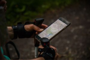
As a hiker, you know the importance of having a reliable mapping tool.
Two of the market’s most popular options, CalTopo and Gaia GPS, have many valuable features and benefits for beginners and professional outdoor enthusiasts.
However, which one is the best for your specific needs?
Below, I’ll compare CalTopo vs. Gaia for hiking, including their features, usability, and overall value, so let’s dive right in.
CalTopo vs. Gaia for Hiking: Which Has Better Maps?
CalTopo offers a range of map layers, including topographic, satellite, and street maps.
Topographic maps come in different scales and show contour lines, elevation, water, and other terrain features.
They also offer different customizable overlays, such as slope angle shading, which can help hikers to identify avalanche-prone areas.
CalTopo also provides real-time weather data and avalanche forecasts in certain areas.
Satellite maps are high-resolution images of the Earth’s surface, and they can be useful for identifying trails, landmarks, and obstacles on the ground.
CalTopo offers different satellite imagery options, such as aerial imagery and satellite imagery from various sources like Landsat and Sentinel.
CalTopo also allows users to create custom maps by layering different data sets, such as USGS topo maps and aerial imagery.
This feature allows users to customize their maps according to their specific needs.
On the other hand, Gaia GPS offers various map layers, including topographic, satellite, and street maps.
The topographic maps offered by Gaia GPS resemble CalTopo’s, showing contour lines, elevation, water features, and other terrain features.
They also offer a variety of overlays, such as weather data and wildfire data.
Moreover, Gaia GPS offers satellite imagery options from various sources, such as Mapbox Satellite and Google Satellite.
Gaia GPS provides access to National Geographic Trails Illustrated maps, which offer detailed topographic maps with marked trails, campgrounds, and other outdoor recreation features.
CalTopo and Gaia GPS offer high-quality maps for hikers, and the choice between the two will depend on personal preference and specific needs.
CalTopo provides advanced customization options and tools, making it a better option for experienced users who require more advanced features.
On the other hand, Gaia GPS has a simpler and more user-friendly interface, making it a better option for beginners or those who prefer a simpler mapping tool.
CalTopo vs. Gaia for Hiking: Which Has Better Route Planning?
CalTopo offers a range of tools to help hikers plan their routes.
Users can create routes by clicking on the map, and the software automatically creates a path that follows the terrain.
The software allows users to adjust the route by adding waypoints or dragging the path to follow a different path.
CalTopo also provides elevation profiles, which display the elevation changes along the planned route.
This can be useful for estimating the difficulty of the hike and planning breaks.
Additionally, CalTopo allows users to customize the route by adding text and symbols to the map, making it easier to identify important landmarks.
In comparison, with Gaia GPS, users can create routes by clicking on the map, and the software generates a path that follows the terrain.
The software also allows users to adjust the route by adding waypoints or dragging the path to follow a different path.
Gaia GPS provides elevation profiles that show the elevation changes along the planned route, similar to CalTopo.
Additionally, Gaia GPS allows users to create “waypoints” along the route that can be used to identify important landmarks or potential hazards.
Both services offer powerful route-planning tools for hikers. Therefore, choosing between CalTopo vs. Gaia for hiking will depend on your needs.
CalTopo vs. Gaia for Hiking: Which Has Better Real-Time Navigation?
CalTopo’s real-time navigation features include GPS tracking, allowing hikers to track their location on the map as they hike.
Moreover, CalTopo provides access to real-time weather data and avalanche forecasts in certain areas, which can help hikers plan their routes and stay safe.
CalTopo also offers offline maps, which can be downloaded in areas with limited or no cellular coverage.
Offline maps can be used with GPS tracking to provide real-time navigation, even off-grid.
On the other hand, Gaia GPS also offers GPS tracking for real-time navigation.
The software includes an “active track” feature, which tracks the user’s location as they hike and displays the path on the map.
Gaia GPS also provides access to real-time weather and wildfire data, which can help hikers plan their routes and stay safe.
Gaia GPS also offers offline maps, which can be downloaded in areas with limited or no cellular coverage.
You can use the downloaded offline maps with GPS tracking for real-time navigation, even in remote locations.
CalTopo’s access to real-time weather data and avalanche forecasts may suit hikers navigating mountainous regions.
On the other hand, Gaia GPS’s active track feature may be more suitable for hikers who prefer a more dynamic and visual real-time navigation experience.
CalTopo vs. Gaia for Hiking: Which App is Easier to Use?
CalTopo’s interface can appear cluttered and overwhelming initially, especially for beginners.
However, the software offers a range of tools and customization options that can be helpful for more experienced hikers.
CalTopo’s tools aren’t easy to use, as they’re organized into tabs and menus, which can take some time to learn.
However, the software offers tutorials and guides to help users get started.
Additionally, CalTopo’s user community is active and helpful, and users can find answers to common questions and issues on the CalTopo forums.
Gaia GPS has a more streamlined and user-friendly interface, with tools and features organized into a simple menu system.
The software is designed to be intuitive and easy to use, even for beginners.
Gaia GPS also offers tutorials and guides to help users get started, and the software’s customer support team is available to answer questions and provide assistance.
Gaia GPS has a large user community, with many resources on the forums.
CalTopo vs. Gaia for Hiking: Which is Cheaper?
CalTopo offers both free and paid software versions.
The free one includes basic mapping tools, such as topographic and satellite maps, and the ability to plan routes and print maps.
The paid version, called CalTopo Pro, offers more advanced features, such as access to real-time weather data, avalanche forecasts, and high-resolution satellite imagery.
CalTopo Pro is priced at $20 per year for an individual subscription or $50 per year for a team subscription.
On the other hand, Gaia GPS offers a range of pricing options, including a free version and several paid subscription levels.
The free version includes basic mapping tools and the ability to plan routes.
The paid subscription levels include Gaia GPS Membership, Gaia GPS Premium, and Gaia GPS Premium Membership.
These levels offer extras, such as access to real-time weather data, download and save maps for offline use, and access to National Geographic Trails Illustrated maps.
Gaia GPS Membership is priced at $19.99 per year, Gaia GPS Premium is priced at $39.99 per year, and Gaia GPS Premium Membership is priced at $119.99 per year.
CalTopo vs. Gaia for Hiking: What’s Your Pick?
CalTopo vs. Gaia for hiking, which meets your needs? I think CalTopo and Gaia GPS have their strengths and weaknesses in hiking.
CalTopo is excellent for planning routes and printing maps, while Gaia GPS offers a more user-friendly interface and a larger selection of map layers.
Choosing between CalTopo vs. Gaia for hiking will ultimately depend on your needs.
I hope this article has helped you make a well-informed decision and that you can now confidently hit the trails, knowing that you have the best mapping tool for your journey.
I was working as a mountain guide, probably all around the planet. One day, I met my wife in the mountains, literally on top of the world. Now, I have a beautiful family and three kids, so I don’t have much time for climbing, but sometimes I go camping with my friends. I am also into gym workouts, and I can’t imagine my life without sports.
Since I ended my professional career as a climbing guide, I’ve been giving personal classes and helping amateurs to get ready for conquering their first peaks. Also, that’s how the whole blog idea appeared.